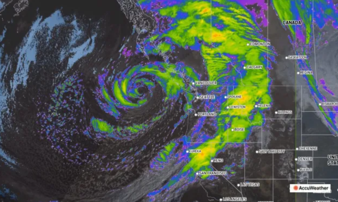
A once-in-a-decade ‘bomb cyclone’ has hit the US’s West Coast, primarily Washington and Oregon, with much of California impacted as well. The area is expected to have extremely heavy rainfall and high winds for the next week as the massive storm continues to roll over the region.
A bomb cyclone is categorized by a quickly developing, widely-spanning storm with high moisture. In this case, tropical winds from the south met polar winds to create a massive storm not seen for decades on the West Coast. A normal storm of this caliber would be massively impactful, but this one is stronger still due to another critical factor- the storm is hitting an atmospheric river.
An atmospheric river is a narrow current of winds in the atmosphere that carry moist air from the equator to the polar regions. The addition of these winds to the cyclone, along with the air they carry, has supercharged this storm with even more harsh clashes between low and high pressure air masses and even more moist air to fuel the flooding that has begun to hit the West Coast.
The storm has already brought destruction to the Coast, as almost 300,000 homes in Washington were without power last Wednesday, and over 70,000 more across the border in Canada. Several have been killed in Washington and around Seattle, and more are expected to be injured or killed as the cyclone hits the river.
The wind gusts of the cyclone have ranged from 60-101mph, posing a hazard to travel and key infrastructure such as powerlines. Flooding is expected to continue into next week as the cyclone spits out more and more rain from the river, especially in Oregon and Northern California, where a level 4 flooding risk (the highest on the scale) is predicted.
The cyclone is already tied for the strongest in history to hit the West Coast, and only continues to impact the region. Precipitation is also expected to continue into California as snow, where it will pose an obstacle to travel and isolated communities in higher elevations. The snow may also pose a future risk as it melts, where more flooding will be caused.
The cyclone is slowly dying down for now, though a second, weaker cyclone is still expected to develop on the atmospheric river. For now, residents will just have to listen to local authorities and weather officials’ direction to pursue the safest path forward.


